Newcastle City Council
Tree preservation zone
There is a problem
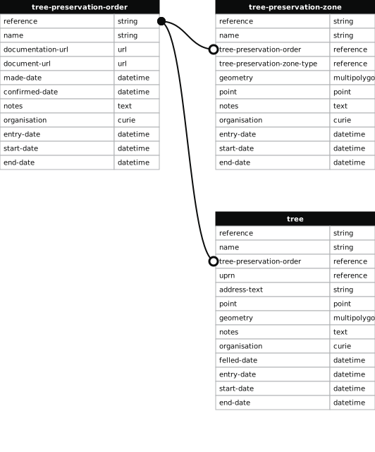
- 1000 entries with tree-preservation-order field must match the reference field in the tree preservation order dataset
Woolsington Bridge
- reference
- 2004/003.G1
- name
- Woolsington Bridge
- tree-preservation-order
- 2004/003
- tree-preservation-zone-type
- group
- geometry
- MULTIPOLYGON (((-1.697886 55.023178,-1.697853 55.023190,-1.697814 55.023199,-1.697723 55.023208,-1.697696 55.023216,-1.697683 55.023222,-1.697675 55.023257,-1.697712 55.023290,-1.697787 55.023343,-1.697816 55.023357,-1.697851 55.023369,-1.697883 55.023369,-1.697913 55.023360,-1.698045 55.023292,-1.698276 55.023183,-1.698292 55.023171,-1.698282 55.023154,-1.698223 55.023103,-1.698184 55.023076,-1.698147 55.023058,-1.698111 55.023053,-1.698078 55.023065,-1.698062 55.023078,-1.697886 55.023178)))
- point
- POINT (-1.697985 55.023216)
- notes
- These data are update live via a feed to NCC's Tree Managament System, EzyTreev
- entry-date
- 2022-07-01
- start-date
- 2004-09-09
- end-date
How to fix this issue
Your data is missing a tree-preservation-order.
The tree preservation zone guidance explains how to fix the issue:
tree-preservation-order
The reference for the tree preservation order that covers this zone.
How to improve Newcastle City Council’s data
- Fix the errors indicated
- Use the check service to make sure the data meets the standard
- Publish the updated data on the endpoint URL